Reading Weather for Safe Sailing
Reading weather is a fundamental skill for safe sailing. It involves observing cloud formations, detecting wind shifts, and monitoring barometric trends to anticipate storms and make informed decisions. While modern forecasting tools provide valuable data, the ability to interpret natural signs remains essential for mariners. This article outlines key indicators and methods to help sailors assess weather conditions before and during a passage.
Understanding these signs allows for proactive planning and adjustments. It is important to note that no single indicator guarantees an outcome; rather, a combination of observations and forecasts provides a more complete picture. The information presented here is for educational purposes and should be used in conjunction with official forecasts and professional judgment.
By developing observational skills, sailors can enhance their situational awareness and contribute to safer voyages. The following sections explore cloud formations, wind shifts, and barometric trends in detail, offering a framework for integrating these elements into decision-making processes.
Cloud Formations and Their Significance
Clouds are visible manifestations of atmospheric processes. Their type, altitude, and evolution can signal changing weather. High-altitude cirrus clouds, for instance, often indicate an approaching warm front, which may bring precipitation and shifting winds. As the front nears, cirrus may thicken into cirrostratus, creating a halo around the sun or moon. This progression can be an early clue of deteriorating conditions.
Cumulus clouds, with their flat bases and fluffy tops, typically indicate fair weather when they remain small and well-separated. However, when they grow vertically into cumulus congestus or cumulonimbus, they can produce thunderstorms, heavy rain, and squalls. Observing the speed of vertical development is crucial; rapid growth suggests strong updrafts and potential instability. Mariners should monitor for darkening bases and increasing height.
Stratus clouds form low, uniform layers that can reduce visibility and bring drizzle. While not usually associated with severe weather, persistent stratus can indicate stable, moist air. Altostratus clouds, a middle-level layer, often precede rain and can thicken into nimbostratus, which produces steady precipitation. Recognizing these transitions helps sailors anticipate changes in wind and visibility.
In the UK, the convergence of different air masses frequently leads to varied cloudscapes. The classic sequence from cirrus to cirrostratus to altostratus to nimbostratus is a textbook example of a warm front approaching. By noting the direction of movement and rate of change, sailors can estimate the time until conditions deteriorate. This method is not foolproof, but it adds a layer of awareness.
Wind Shifts: Indicators of Change
Wind is the primary driver of weather systems. Shifts in wind direction and speed often precede significant changes. A veering wind (shifting clockwise) typically indicates the passage of a warm front or the approach of a high-pressure system, while a backing wind (shifting counterclockwise) can signal a cold front or low-pressure system. Observing these shifts helps in anticipating the associated weather.
In the Northern Hemisphere, the wind around a low-pressure system circulates counterclockwise. As a low approaches, winds may back and increase in strength. After the front passes, winds veer and often become gusty. Monitoring wind shifts can provide early warning of squalls or changes in sea state. An abrupt increase in wind speed, especially with a sudden shift, may indicate a gust front from a thunderstorm.
Sailors should pay attention to local effects, such as sea breezes, which can mask or modify larger-scale wind patterns. In coastal areas, the diurnal cycle of sea and land breezes can cause regular wind shifts. Understanding these patterns helps distinguish between normal fluctuations and significant changes. For example, a sea breeze that fails to develop or reverses unexpectedly can indicate an approaching system.
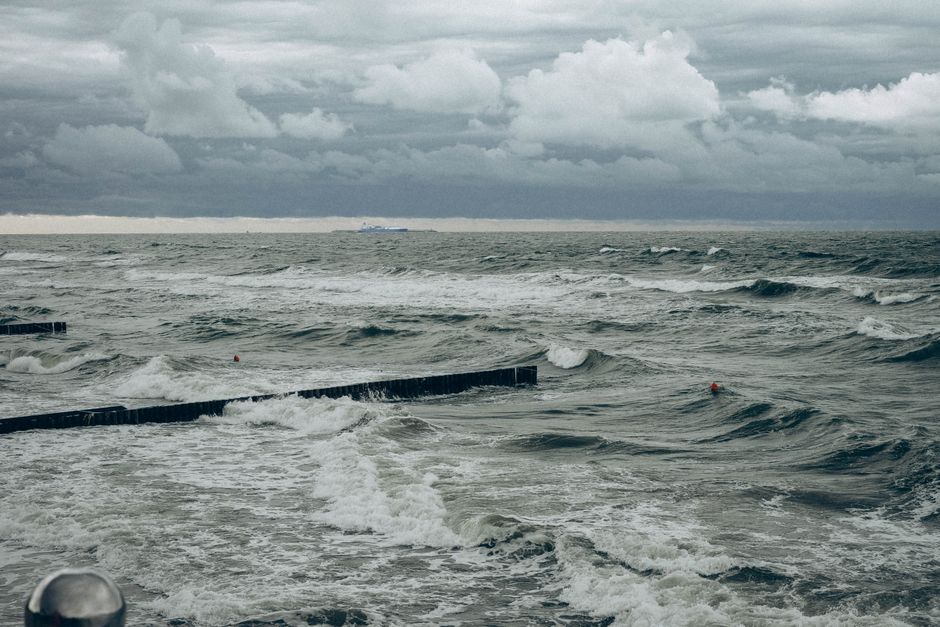
Anemometers and wind indicators are useful tools, but visual observations of the sea surface, such as the appearance of whitecaps or changes in wave direction, can confirm wind shifts. Combining instrument data with visual cues enhances accuracy. It is important to record wind observations regularly to identify trends and deviations from forecasts.
“The wind is the messenger of the weather; its shifts and increases are calls to attention.”
Barometric Trends: The Weight of the Air
Barometric pressure is a direct measure of atmospheric mass. A falling barometer often indicates an approaching low-pressure system, which can bring unsettled weather. The rate of fall is significant: a rapid drop (more than 1 hPa per hour) suggests a fast-approaching system, possibly with strong winds. A slow, steady fall may indicate a gradual change over hours or days.
Conversely, a rising barometer typically signals improving weather as high pressure builds. However, a very rapid rise can bring strong, gusty winds. The absolute pressure value is less important than the trend. For instance, a pressure of 1000 hPa that is falling steadily is more concerning than a steady 990 hPa. Mariners should track pressure over time, ideally every hour, to detect trends.
In the UK, the passage of depressions is common, and barometric trends are a key forecasting tool. A falling barometer accompanied by increasing wind and cloud cover suggests an approaching front. After the front passes, pressure may stabilise or rise, with a shift in wind direction. Recognising these patterns helps in planning route changes or timing of passages.
Barographs or digital barometers with trend indicators are valuable onboard instruments. Recording pressure readings in a log allows for comparison with official forecasts and helps in identifying discrepancies. It is important to remember that local effects, such as altitude, can influence pressure; however, at sea level, trends are generally representative of synoptic-scale changes.
Integrating Observations for Decision-Making
Effectively reading weather requires synthesising cloud, wind, and pressure observations. A holistic approach involves cross-checking these indicators against each other and against forecast information. For example, if clouds are thickening, wind is backing, and pressure is falling, the likelihood of a low-pressure system approaching is high. This convergence of signs increases confidence in the assessment.
Decision-making should be based on a combination of factors, including vessel capabilities, crew experience, and passage requirements. No single indicator should dictate a course of action. Instead, sailors can use a checklist or decision matrix to evaluate risk. It is prudent to err on the side of caution when multiple indicators suggest deterioration.
Recording observations in a logbook creates a valuable record for future reference. Over time, patterns may emerge that are specific to certain regions or seasons. This historical data can inform future passages. Sharing observations with other mariners can also enhance collective knowledge.
While technology provides access to real-time forecasts, the ability to interpret natural signs remains a cornerstone of seamanship. It fosters self-reliance and provides a backup when electronic systems fail. By integrating traditional skills with modern tools, sailors can make more informed and timely decisions.
Conclusion
Reading weather for safe sailing is a continuous process of observation and interpretation. Cloud formations, wind shifts, and barometric trends are interconnected elements that offer clues about upcoming conditions. Developing proficiency in these areas enhances situational awareness and supports prudent decision-making. It is essential to remember that weather prediction is probabilistic, and conditions can change rapidly. Therefore, maintaining flexibility and preparedness is key.
Mariners should always consult official forecasts and use their own observations to validate or adjust plans. The information provided here is not a substitute for professional weather routing services or formal training. Each voyage is unique, and decisions should be tailored to the specific circumstances. With practice, sailors can improve their ability to read the sky and sea, contributing to safer and more enjoyable passages.