Coastal Navigation with Paper Charts
Coastal navigation using paper charts remains a fundamental skill for mariners, offering a reliable fallback when electronic systems fail. While modern electronic navigational aids provide convenience and precision, the ability to navigate with traditional tools ensures safety and independence. This article explores the methods and tools used for dead reckoning and piloting along coastlines, focusing on the use of paper charts, parallel rules, and dividers. By understanding these techniques, mariners can maintain situational awareness and confidently navigate even when technology is unavailable.
The reliance on electronic devices for navigation has become commonplace, but these systems can be disrupted by power failures, signal loss, or equipment malfunction. In such situations, a solid grasp of paper-based navigation becomes invaluable. This article outlines the core principles and practical steps involved in coastal navigation, emphasising the importance of preparation, practice, and a systematic approach. Whether you are a seasoned sailor or a novice, these skills contribute to safer voyages and greater self-reliance on the water.
In the following sections, we will examine the essential tools, the process of dead reckoning, and the techniques of piloting. We will also discuss how to integrate these methods with modern practices for a comprehensive navigational strategy. The goal is to provide a clear, informative guide that supports mariners in developing and maintaining proficiency in traditional navigation.
Essential Tools for Paper Chart Navigation
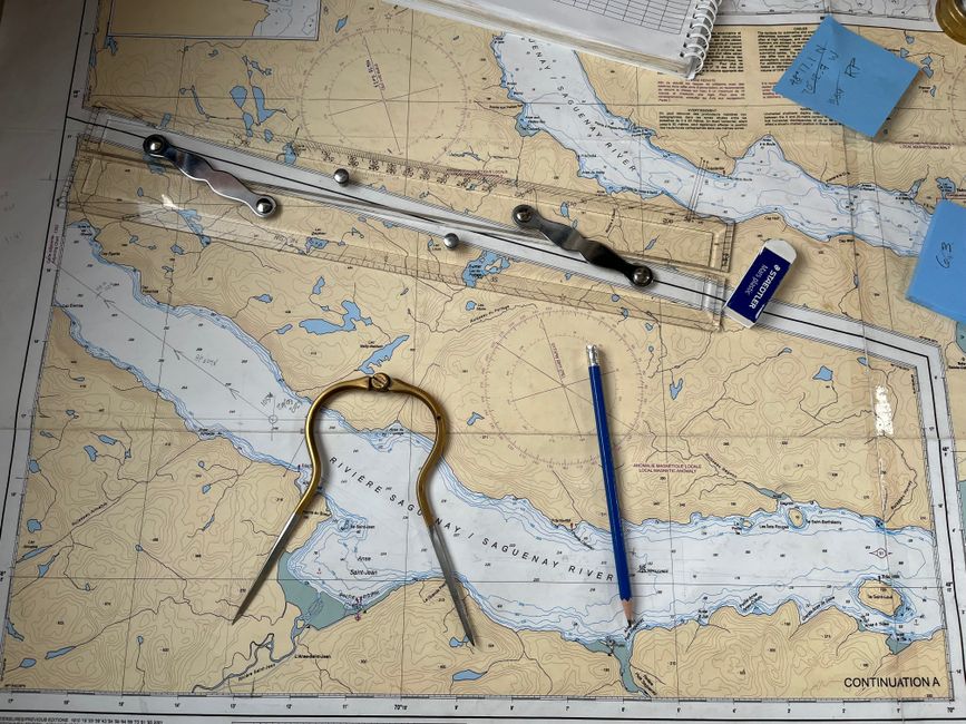
Navigating with paper charts requires a set of basic tools that have stood the test of time. These instruments are simple, robust, and do not rely on electricity or satellite signals. The primary tools include the paper chart itself, parallel rules, dividers, and a pencil. Each tool serves a specific purpose and, when used together, allows for accurate plotting and measurement.
Paper charts are detailed representations of coastal areas, including depth soundings, navigational aids, landmarks, and hazards. They are typically printed on durable paper and are updated periodically to reflect changes in the marine environment. A chart provides a wealth of information that is immediately accessible without the need for a screen or battery. Understanding chart symbols and abbreviations is essential for effective use.
Parallel rules are used to transfer lines of bearing or course from the compass rose on the chart to the area of operation. They consist of two straightedges connected by hinges, allowing them to be walked across the chart while maintaining a constant angle. This enables the navigator to draw lines parallel to a given direction. Dividers, on the other hand, are used to measure distances between points on the chart. By comparing the span to the latitude scale on the chart’s edge, distances in nautical miles can be determined.
In addition to these core tools, a pencil and eraser are necessary for plotting. A sharp pencil ensures precise lines, while an eraser allows for corrections. A notebook or logbook is also useful for recording courses, speeds, and times. Together, these tools form the foundation of traditional coastal navigation.
Understanding Dead Reckoning
Dead reckoning is a method of estimating a vessel’s current position based on a previously known position, the course steered, the speed through the water, and the time elapsed. It does not rely on external references such as landmarks or electronic signals. Instead, it uses mathematical calculations and plotting on a chart.
To perform dead reckoning, the navigator starts from a known position, often obtained from a fix. The course steered is recorded from the vessel’s compass, and the speed is measured using a log or estimated from engine RPM. The time run on each course is noted. Using the formula distance = speed × time, the distance travelled is calculated. This distance is then measured on the chart using dividers and marked along the course line from the starting position.
The process is repeated for each leg of the voyage, creating a series of plotted positions that represent the vessel’s estimated track. However, dead reckoning is subject to errors from various sources, including compass deviation, variation, leeway, and currents. These factors can cause the actual position to differ from the dead reckoning position. Therefore, it is essential to update the dead reckoning position with fixes obtained from piloting or other methods whenever possible.
Despite its limitations, dead reckoning provides a continuous estimate of position and is a valuable skill when electronic navigation fails. It encourages the navigator to maintain a mental picture of the vessel’s progress and to anticipate potential hazards. Regular practice improves accuracy and confidence in this technique.
Piloting Along Coastlines
Piloting, also known as pilotage, is the art of navigating by reference to visible landmarks, navigational aids, and depth soundings. It is particularly useful in coastal waters where features such as lighthouses, buoys, and prominent buildings can be identified. Piloting often complements dead reckoning by providing fixed positions to reset the dead reckoning plot.
To pilot effectively, the navigator uses a combination of visual observations and chart work. Bearings taken with a compass or hand-bearing compass are plotted on the chart to determine lines of position. The intersection of two or more lines of position provides a fix, which is the vessel’s actual position. Landmarks should be chosen for their distinctiveness and ease of identification, and their bearings should be taken as close to simultaneously as possible to minimise error.
Depth soundings are another key element of piloting. By comparing the measured depth with the charted depth, the navigator can gain an indication of position relative to the shoreline and underwater features. A lead line or echo sounder can be used for this purpose. However, depth soundings alone are rarely sufficient for a fix; they are best used in conjunction with visual bearings.
Piloting requires a thorough understanding of the chart and the ability to quickly identify landmarks. It also demands constant vigilance, as conditions can change rapidly. When electronic systems are unavailable, piloting becomes the primary means of coastal navigation, allowing the mariner to navigate safely through channels and around hazards.
Integrating Traditional and Electronic Navigation
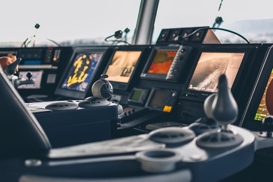
While this article focuses on paper-based methods, it is important to recognise the value of integrating traditional and electronic navigation. Electronic systems such as GPS and chartplotters offer unparalleled accuracy and convenience, but they should not be solely relied upon. A prudent mariner uses all available means to determine position and cross-check information.
When electronic systems are functioning, they can be used to verify the dead reckoning plot and provide fixes. Conversely, when electronics fail, the skills of dead reckoning and piloting ensure continuity of navigation. This redundancy is a cornerstone of safe navigation, particularly in coastal waters where hazards are close and the consequences of error are significant.
Maritime Compass encourages mariners to practice traditional navigation regularly, even when electronic aids are available. This practice maintains proficiency and builds confidence in case of failure. It also deepens understanding of the marine environment and the factors that affect a vessel’s movement.
By combining the strengths of both traditional and electronic methods, mariners can achieve a robust navigational strategy that is resilient to equipment failure. The key is to remain adaptable and to use every tool at one’s disposal to ensure the safety of the vessel and crew.